


April is the month in which we celebrate National Read a Road Map Day (April 5 to be exact). When was the last time you used a road map to find your destination, or identify where you are? Chances are, if you were born in the late 80s or after, most of your travel sans parents has most likely not included ensuring you had a road map packed.
The first known road map dates to 1160 BC and depicts a portion of Ancient Egypt routing the reader across dry riverbeds. Certainly, since then rudimentary maps have been drawn showing travelers, pioneers, and adventurers how to get from Point A to Point B, highlighting landmarks along the way to help ensure they are heading in the right direction.
With the advent of automobile travel in the 1900s, the American Automobile Association, also known as AAA, began to publish road maps. However, it was the Rand McNally Road Atlas that became the traveler’s bible, so to speak. First published in 1924, the 2020 edition marks the 96th anniversary of this iconic traveler’s companion that compiled a comprehensive state by state road map system that grew to include mileage charts, detours and road construction information, and detailed major city maps for each state. In addition to helping navigate, it served as a boredom buster for the travel companions who may never have had a notion to find out where some of the more obscure cities and town across our great land were located!
Let’s look at the some of the major, and minor, road trips you can plan using road maps. Of course, some knowledge of map reading is required so if you’re unfamiliar with a road map or the road atlas, find your favorite Boomer and listen up!
Most road atlases should contain an overview of the US highway system and that is a good way to find out which roads can be used for transcontinental travel, or at least one long stretch from Point A to Point B without too much discussion on turns, exits, etc. It can also point you toward the roads less traveled, which will still get you from Point A to Point B, although it just may just take a bit longer.
Interstate 80: Stretching over 2900 miles, Interstate 80 was started in 1956 and is one of the original routes of the Interstate Highway System. It runs from San Francisco in the west across the country to the east coast terminus of Teaneck, New Jersey. With a little off-road navigation (read the map) you can connect to a few of our campgrounds in New Jersey, Pennsylvania, Ohio, Indiana, Illinois, Nevada, and California.


Lincoln Highway: Originally a transcontinental highway, which ran from New York’s Times Square to San Francisco’s Lincoln Park, the Lincoln Highway opened to roadsters back in 1913. With the advent of the Interstate Highway Systems, parts of the Lincoln Highway were absorbed into Interstate I-80, however, historic markers can still be found including one in New Carlisle, Indiana (home to Lakeside RV Campground) and at the western terminus marker in San Francisco’s Lincoln Park (about a 20 minute drive from San Francisco RV Campground.)


Interstate 95: Take I-95 and you can travel from Maine on south to Miami. Take your time on the longest north-south route in the US and hit cities (and campgrounds) along the way near Portland, Maine (Moody Beach RV Campground), Boston, Massachusetts (Cape Cod campgrounds), Philadelphia, Pennsylvania (Scotrun RV Campground and Hershey RV Campground), Richmond, Virginia (Williamsburg RV Campground), Florence, South California (Oaks at Point South RV Campground), and the Atlantic coast RV resorts in Florida including Sunshine Holiday RV Campground in Fort Lauderdale and Miami Everglades RV Campground in Miami.

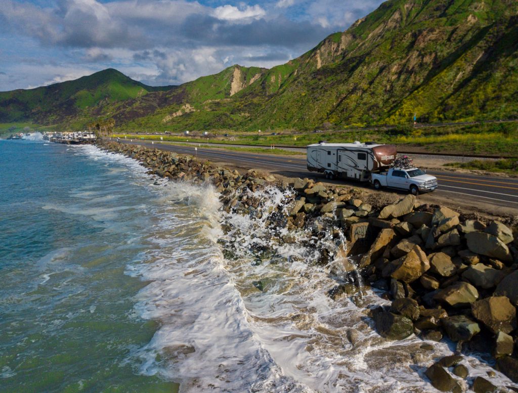
Pacific Coast Highway: Also known as Route 101, this road will take you up or down the Pacific Coast, whichever way you prefer, all the way from Washington’s capital city of Olympia to California’s largest city, Los Angeles. Highlights along the way include Seattle’s Pike Place Market, Oregon’s Cannon Beach and the picture-demanding Haystack Rock, and California gems such as Redwood National Park, Fort Bragg’s Glass Beach, and San Fran’s iconic Golden Gate Bridge. Take your time on this beautiful journey and enjoy the abundance of our campgrounds along the way (check ThousandTrails.com for nearby locations.)